
Sudoor Manthan- IIRS Science Portal
Kartikeya Gaur, Pankaj R. Dhote and Praveen K. Thakur
Inland water bodies play a crucial role in sustaining ecosystems, supporting agriculture, and regulating hydrological processes. Continuous monitoring of water levels is essential for effective water resource management and risk assessment, particularly in regions where ground-based observations are sparse. Traditional satellite altimeter missions have provided valuable insights into water storage and flow dynamics, but their non-imaging configuration and spatial coverage limitations have left gaps in understanding smaller rivers, reservoirs, and glacial lakes. The Surface Water and Ocean Topography (SWOT) mission bridges this gap by offering two dimensional (2D) high-resolution measurements of water surface elevations (WSE), river widths, and slopes on global scale allowing for more accurate assessments of hydrological changes, including estimates of river flow and lake/reservoir storage changes.
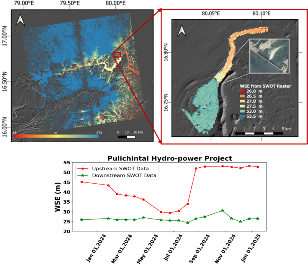
Figure 1. SWOT-derived 2D WSE over Pulichintala multi-purpose water management project and temporal variability of WSE at upstream and downstream locations.
The SWOT mission represents a major advancement in global hydrology by providing detailed, 2D water height data across various inland water bodies. This capability enhances hydrological models by improving the estimation of river discharge, water storage changes, and fluxes within the water cycle. As an example in figure 1, we illustrate water level variations upstream (U/S) and downstream (D/S) of the Pulichintala Hydro-Power Project on the Krishna River, located along the border of Telangana and Andhra Pradesh. The time series analysis reveals that water levels peak during the monsoon months and gradually decline as water is diverted for irrigation and other uses.
The integration of SWOT observations with in-situ measurements and other satellite datasets will refine our understanding of surface-subsurface water interactions and the effects of climate change on hydrological systems. Furthermore, SWOT’s data can contribute to broader Earth system studies, including research on greenhouse gas emissions from inland waters, ultimately improving climate models and informing sustainable water management strategies.
References