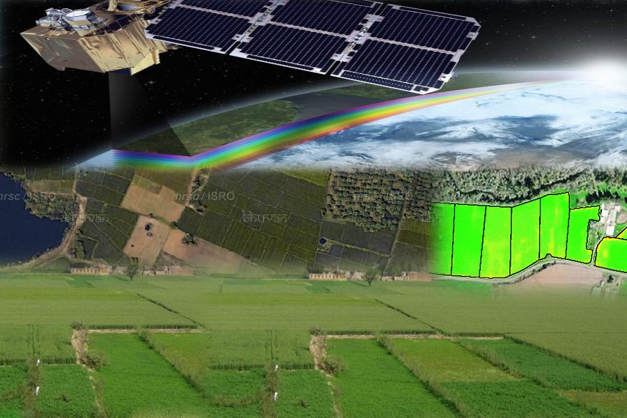
Multi temporal NDVI composite help in distinction of rice and sugarcane dominated regional patterns in northern India
Agriculture is important for the Indian society due to its importance in economy, employment, food security, national self reliance and general well being. Generation of crop statistics in India dates back to historical Mauryan ( Kautilya’s Arthasastra) as well as Moghul era (Todarmal Bandobast).
In modern era, the Government of India is regularly generating crop statistics. The first multispectral airborne study in the country in 1969 was jointly conducted by ISRO and ICAR and demonstrated identification of root-wilt disease in coconut using aerial false colour photograph over Kerala (Dakshinamurti et al. 1971). Since then, there have been many investigations on various aspects of crop identification and area estimation using air-borne to space borne sensors for different crops and agricultural regions in India.
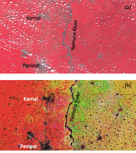
Figure 1: (a) False colour single date image of Resourcesat AWiFS (23 Sept. 2024) and (b) Multi date NDVI colour composite (Red: 25 Aug. 2024, Green: 25 June 2024 and Blue: 25 April 2024) of Sentinel-2 satellite over parts of Haryana and Western Uttar Pradesh (Courtesy: VEDAS SAC web portal).
Generally, crops are discriminated by their distinct spectral signatures in single date observations. Like irrigated crops are associated with high vigour as compared to unirrigated crops (Dadhwal et al. 2002). A multi-temporal approach is used when single date data does not permit accurate crop discrimination. Figure 1a shows the single date observation from Resourcesat AWiFS data of 23 Sept. 2024 and Figure 1b shows multi date NDVI colour composite generated from August, June and April 2024 data of Sentinel-2 satellite. Multi date NDVI composite image show unique advantage over single date observations in crop discrimination. We can see that homogeneous crop cover in both side of Yamuna river in red colour (Fig. 1a) in single date FCC data. But a more diverse pattern of colour separated by Yamuna River in multi date NDVI composite can be observed showing unique distinction of the cropping practice on both side of Yamuna river. Red colour in the left part of the NDVI composite image (Fig. 1b) show rice dominated cropping practice in parts of Haryana and Green and other colours in right part of the image is sugarcane dominated cropping practice in Western Uttar Pradesh. Different colour variations in Figure 1b is due to observations of crop vigor in different phenological stages captured by satellite data. Interesting part of the image is how the two cropping practices are distinctly separated along the Yamuna River which also forms the boundary of states of Haryana and Uttar Pradesh, India. Rice dominated region looks red because the NDVI is higher in August as compared to June and May. Sugarcane region show relatively high NDVI in June.
Cropping practices differ in different parts of India depending on the soil type and climate. Agriculture in India is mainly dependent on monsoon rainfall. There are three different types of crops that are cultivated throughout India. Each type is grown in a different season depending on their compatibility with certain weather. Kharif crops like Rice corn millet are sown at the start of the monsoon season. Rabi crops like wheat are sown in winter during October- November months. The third type of Jaid crops are summer crops.
Satellite data (Resourcesat and Sentinel-2) visualization was carried out using VEDAS portal (https://vedas.sac.gov.in) and the article is contributed by Raghavendra P. Singh, Indian Institute of Remote Sensing, ISRO, Dehradun, India.
References
Dadhwal, V.K., Singh, R.P., Dutta, S., and Parihar, J.S., 2002, Remote sensing based crop discrimination and area estimation: A review of Indian experience. Tropical Ecology, 43, 107-122.
Dakshinamurti, C., Krishnamurthy B., Summanwar, A.S., Shanta, P., Pisharoty, P.R., 1971, Remote sensing for coconut wilt. Proc. of 6th International. Symposium on Remote Sensing of Environment, Environmental Research Institute of Michigan, Ann Arbor, 25-29.