Sanjeev Kumar Singh, Yogesh Kant and D. Mitra
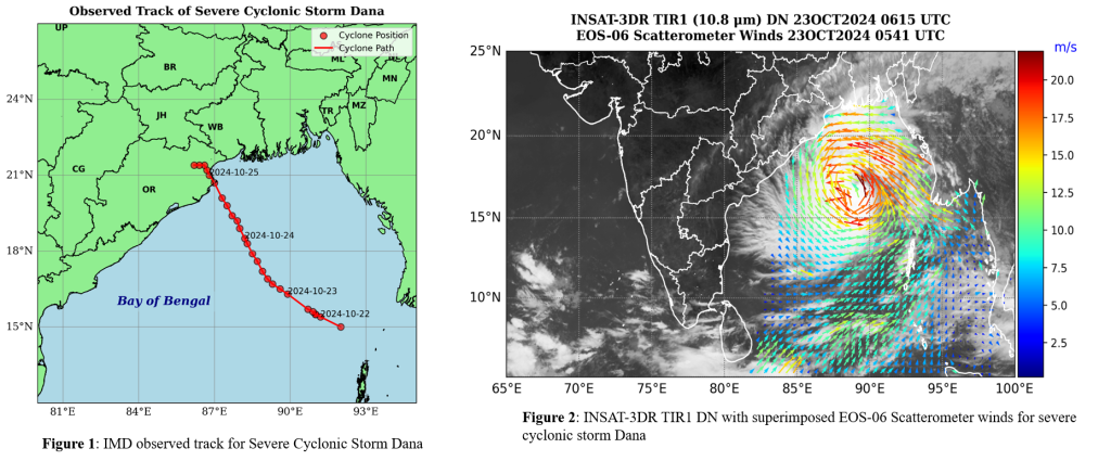
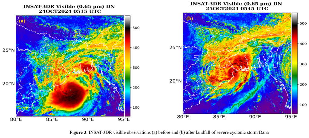
Cyclone Dana was a strong tropical cyclone formed over the Bay of Bengal in October 2024. It was the first cyclone in the post-monsoon cyclone season 2024. Cyclone Dana originated as a low-pressure area over the East Central Bay of Bengal and the adjoining North Andaman Sea on October 21, 2024. On October 22, the system intensified into a depression in the evening and further developed into a deep depression by the same evening and subsequently, it strengthened into a cyclonic storm named “Dana,” on October 23 moving northwestward over the central and northwest Bay of Bengal. By 1800 UTC on October 23 Dana had intensified into a severe cyclonic storm. Finally, Dana cyclone made landfall on the night of October 24 crossing the North Odisha and West Bengal coasts between Puri and Sagar Island, close to Bhitarkanika and Dhamra. The landfall occurred as a severe cyclonic storm during the transition from the night of October 24 to the morning of October 25, 2024. The storm brought strong winds, heavy rainfall, and significant storm surges to the coastal regions of Odisha and West Bengal.

Scatterometer wind measurements are crucial for studying cyclones as they provide detailed information on surface wind speed and direction over the ocean, where traditional weather stations are absent. Scatterometer data with the combination of other satellite imagery (such as infrared and visible) and ground-based measurements is useful for providing complete picture of the cyclone. Figure 2 shows the Indian INSAT-3DR thermal infrared (TIR)-1 DN values with superimposed EOS-06 scatterometer winds on 23 October 2024 for Cyclonic Storm Dana. Scatterometers can detect wind speed patterns that define a cyclone’s structure, including the eye (calm center) and surrounding eyewall (high-speed winds).

The scatterometer shows the wind speed more than 20 m/s over the cyclonic region. Figure 3(a-b) illustrates the visible imagery of INSAT-3DR before and after the landfall of Cyclone Dana. Visible imagery of Cyclone Dana shows a well-defined thick cloud, indicating a strong storm.


