 Harish Chandra Karnatak |
April 20, 2026 |
155 Views |
1 Comments
|
Harish Chandra Karnatak |
April 20, 2026 |
155 Views |
1 Comments
| 
For many years, Geographic Information Systems (GIS) have been seen as complex and highly technical. Even simple tasks like identifying flood‑prone areas or finding suitable land for development require expert knowledge and advanced software skills. Because of this, decision‑making often depended on a small group of GIS specialists. The delay was not because the analysis was difficult, but because the tools were not easily accessible to everyone. In most cases, data was available, but using GIS was a real challenge.
Today, this situation is changing due to progress in Generative Artificial Intelligence and Large Language Models (LLMs). GIS is slowly moving away from rigid, layer‑based workflows system toward more natural and conversational interactions. Instead of clicking through complex menus, users can now ask questions in simple language. This shift makes spatial analysis more approachable and allows non‑experts to work with geographic information confidently and independently.
One major reason for this change is AI’s ability to handle unstructured information. Traditional GIS mostly works with structured data like tables, maps, and predefined attributes. However, a large amount of useful information exists in unstructured forms such as field notes, technical reports, satellite annotations, emails, and even social media posts. Earlier, this information was difficult to include in GIS analysis. Generative AI makes it possible to understand and integrate such data, adding valuable context to spatial decision‑making. At the same time, it introduces new challenges related to data storage, indexing, efficient retrieval, and governance. As a result, GIS system design itself needs to evolve.
It is important to remember that LLMs are not perfect or intelligent in the human sense. They do not truly understand a problem or think independently. Instead, they generate responses based on patterns learned from large amounts of text. Because of this, they may sometimes produce answers that sound correct but are wrong, a problem commonly known as hallucination. In geospatial applications, where outputs may influence critical applications such as disaster management, urban planning, or resource allocation, such mistakes can be serious. Therefore, AI tools in GIS must always include validation mechanisms to ensure that results follow spatial rules, data constraints, and domain knowledge.
Interestingly, very large AI models are not always necessary for geospatial tasks. Smaller language models, with fewer parameters, are proving to be quite effective. They are faster, consume less computing power, and can be easily deployed on edge devices. Their main strength lies in converting simple text queries into actual spatial operations like filtering datasets, creating buffers, or performing overlays. This makes it possible to carry out advanced GIS analysis directly in the field using mobile devices, reducing dependence on cloud systems and enabling quick, real‑time decisions.
To ensure accuracy and reliability, new system designs are being adopted. One such design is the Profiler–Interpreter framework. In this approach, the profiler first summarizes key properties of geospatial datasets such as geometry type, attributes, and spatial extent. The interpreter then uses these summaries, often supported by Retrieval‑Augmented Generation (RAG), to convert user questions into valid GIS commands. Built‑in checks for syntax, topology, and coordinate systems help maintain technical correctness while keeping the interface user‑friendly.
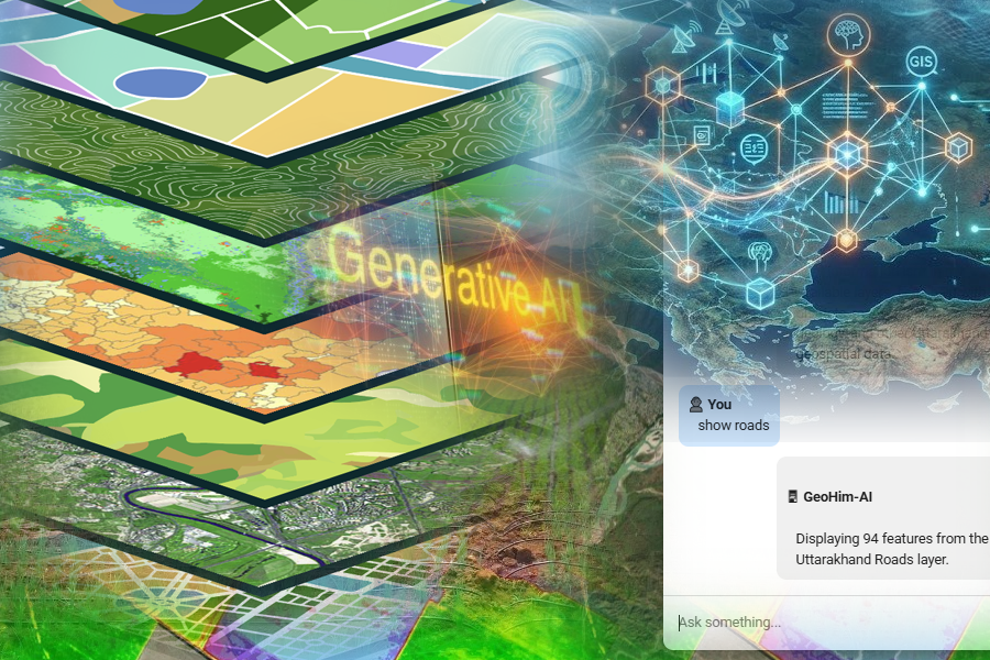
These developments are already visible in the rise of conversational GIS tools like geo‑chatbots. Users can ask straightforward questions, such as finding settlements on low‑productivity agricultural land, while complex spatial processing runs in the background. Such systems reduce dependency on technical experts, improve transparency, and speed up data‑driven decisions, especially in planning and governance activities.
Generative AI is also changing how geospatial knowledge is stored and accessed. Earlier systems relied mainly on keyword‑based searches, which limited data discovery. Now, semantic and context‑aware retrieval methods allow users to find relevant documents even if they do not know the exact technical terms. This transforms geospatial databases from static archives into dynamic knowledge platforms that support learning, exploration, and adaptive decision‑making.
In the future, geospatial AI will increasingly move toward edge‑based deployment. Advances in edge computing and low‑cost sensors make it possible to monitor environmental changes such as landslides, glacier movement, and water levels in real time. These systems can operate with minimal human input and provide early warnings in vulnerable areas. When combined with multi‑modal remote sensing data like optical imagery, SAR, and InSAR, they can detect subtle surface changes that often occur before major events.
Another important trend is the development of agent‑based geospatial systems. Unlike traditional tools that react only when a user asks a question, these systems continuously observe data streams, detect changes, and support proactive decision‑making. By combining AI with domain rules and live data, GIS can move from reactive analysis to anticipatory action. In the coming years, GIS platforms are likely to offer more personalized and scenario‑based insights tailored to individual users.
In summary, the integration of Generative AI into GIS represents a major shift in how spatial information is used. By reducing technical barriers and enabling natural language interaction, GIS is becoming more inclusive and impactful. As systems move toward autonomous, edge‑enabled, and agent‑driven designs, the focus will shift from how analysis is done to how quickly and effectively insights can support decisions for managing and protecting our environment.
References
- Karnatak Harish (2025). Text-to-Map: Conversation with Spatial Data using NLP and Generative AI, Sudoor Manthon-IIRS Science portal- https://sceince.iirs.gov.in.
- Karnatak Harish (2024). Text-to-Map: Innovative technologies for smart education, Sudoor Manthon-IIRS Science portal- https://sceince.iirs.gov.in.
- Devlin, J., Chang, M. W., Lee, K., & Toutanova, K. (2019). BERT: Pre-training of deep bidirectional transformers for language understanding. NAACL-HLT.
- Lewis, P., et al. (2020). Retrieval-Augmented Generation for Knowledge-Intensive NLP Tasks. NeurIPS.
- Gartner (2023). The State of Unstructured Data Management in Enterprises.
- Zhu, X. X., et al. (2017). Deep learning in remote sensing: A comprehensive review. IEEE Geoscience and Remote Sensing Magazine.
Runjun Gogoi
April 23, 2026Very informative